Detalles
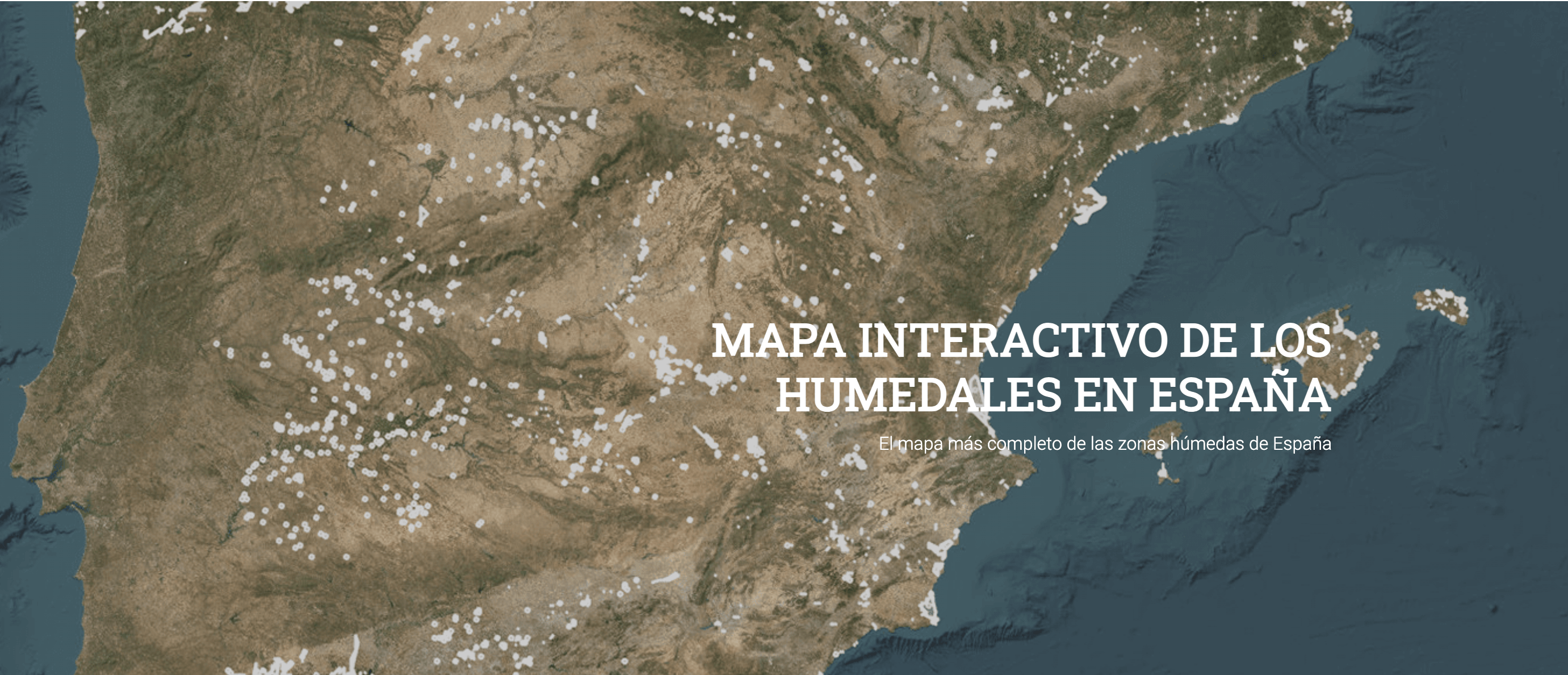
| This interactive map from the Global Nature Foundation shows the data collected from different sources of public information with the aim of showing the official information available so far on the wetlands catalogued in Spain. The basic data of the Spanish Inventory of Wetlands (IEZH) are presented, such as the conservation situation; the regional catalogues published and that have not yet been added to the national inventory; the points located and information available in 2006 from the Spanish Wetlands Documentary Base (BDHE), as well as the wetlands inscribed in Ramsar. The autonomous communities of Extremadura, Cantabria and the Canary Islands have not provided their cartography of their provisional catalogues, so there is no information on these territories in the inventories tab, although they do have points located in the BDHE and Ramsar. |
Recursos relacionados
Why nature matters: Nature-related risks and opportunities for insurance underwriting
This report seeks to raise awareness of the relevance of nature-related risks and opportunities for insurers to explore how the…

Advancing the Green Transition of SMEs: Insights for SME development agencies to support sustainability practices and reporting
This report highlights the importance of ensuring and facilitating the participation of SMEs in driving the green transition. Policymakers and…
SER Europe: Restoring Our Seas: Navigating Challenges, Embracing Opportunities
SER Europe and CLIMAREST organised this webinar to foster a crucial conversation around marine catering standards together with a panel…