Detalles
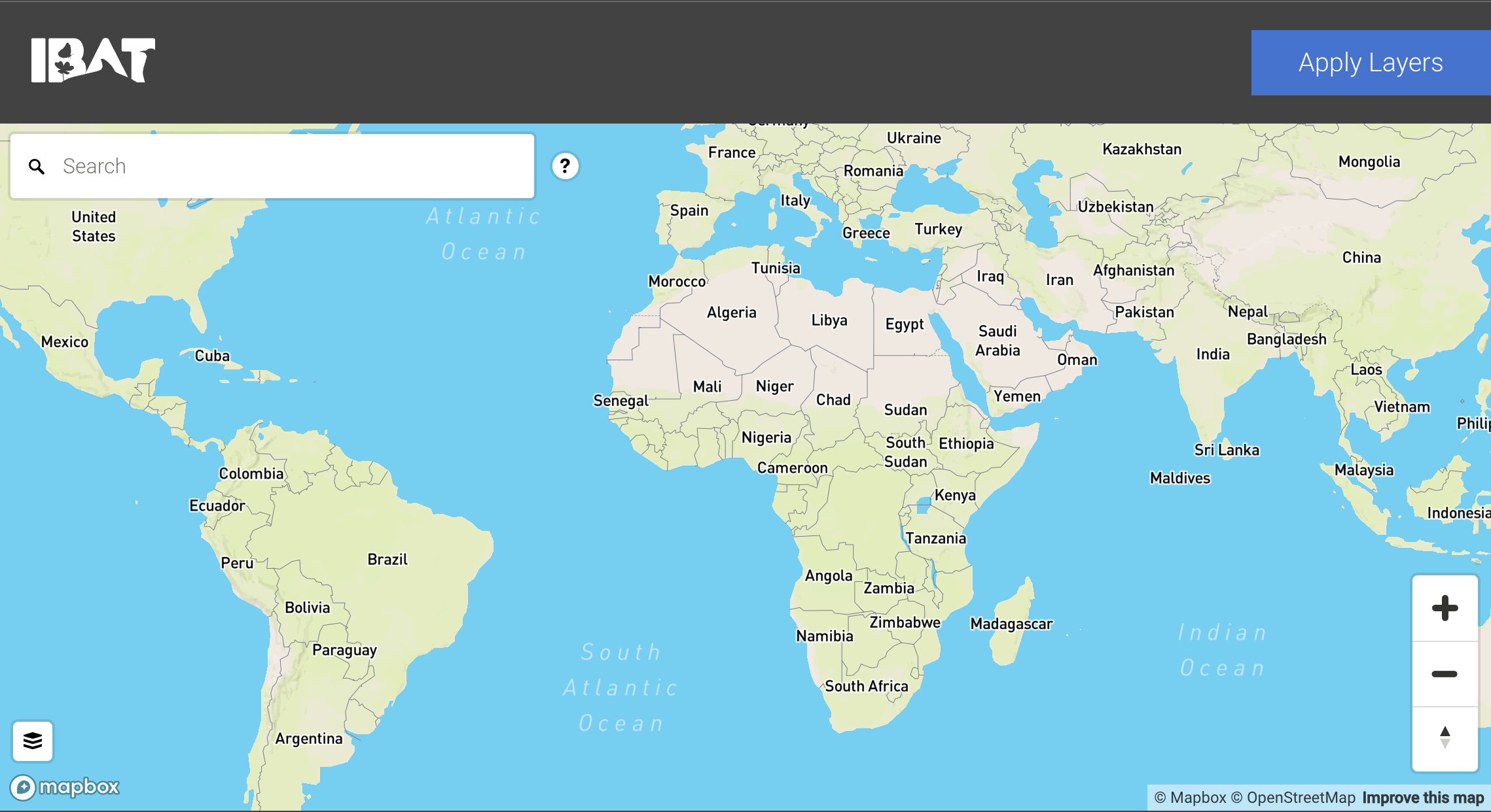
| The TNFD and the Integrated Biodiversity Assessment Tool (IBAT) have collaborated to create an integrated and publicly accessible version of the Integrated Biodiversity Assessment Tool biodiversity map. In response to market feedback on the value of analytical tools to save time and costs in implementing the LEAP approach, the TNFD is collaborating with partners to provide easy access to useful tools for "Localization" phase analysis. These tools are drawn from the TNFD Tool Catalog, which provides a more extensive list of available and applicable tools to support analysis across all phases of LEAP. IBAT can help organizations identify sensitive locations in the L4 component of the "Localization" phase of the LEAP approach. The datasets within IBAT are recommended by the TNFD, as they offer a scientifically sound starting point for assessing the sensitivity of locations based on importance to biodiversity. Identifying sensitive locations is also important to Strategy D of TNFD's recommended disclosures. IBAT's biodiversity map offers a quick visual analysis of critical biodiversity areas globally. Users can explore the interactive map by adding several layers to identify Key Biodiversity Areas, protected areas, and important areas for threatened species. |
Recursos relacionados
The positive impact of conservation action
The current biodiversity crisis calls for action to protect species from extinction and ecosystems from serious degradation. As a result,…

2026
50 Investible Opportunities for a New Nature Economy
El informe analiza cómo la transición hacia una economía positiva para la naturaleza puede generar nuevas oportunidades de negocio y…

New and updated resources to help companies implement IFRS S1 and IFRS S2 from 2024 onwards
Ahead of the ISSB Standards (IFRS S1 and IFRS S2) coming into force in January 2024, the International Sustainability Standards…